Posts with tag 'Why We Love Central Oregon'
Subscribe and receive email notifications of new blog posts.
 RSS Feed
- 2026 | 65 Posts
- 2025 | 103 Posts
- 2024 | 110 Posts
- 2023 | 72 Posts
- 2022 | 52 Posts
- 2021 | 70 Posts
- 2020 | 84 Posts
- 2019 | 38 Posts
- 2018 | 48 Posts
- 2017 | 39 Posts
- 2016 | 31 Posts
- 2015 | 10 Posts
16
Paulina Peak in Newberry National Monument Open for Hiking!
Paulina Peak in Newberry Crater Provides Great Views
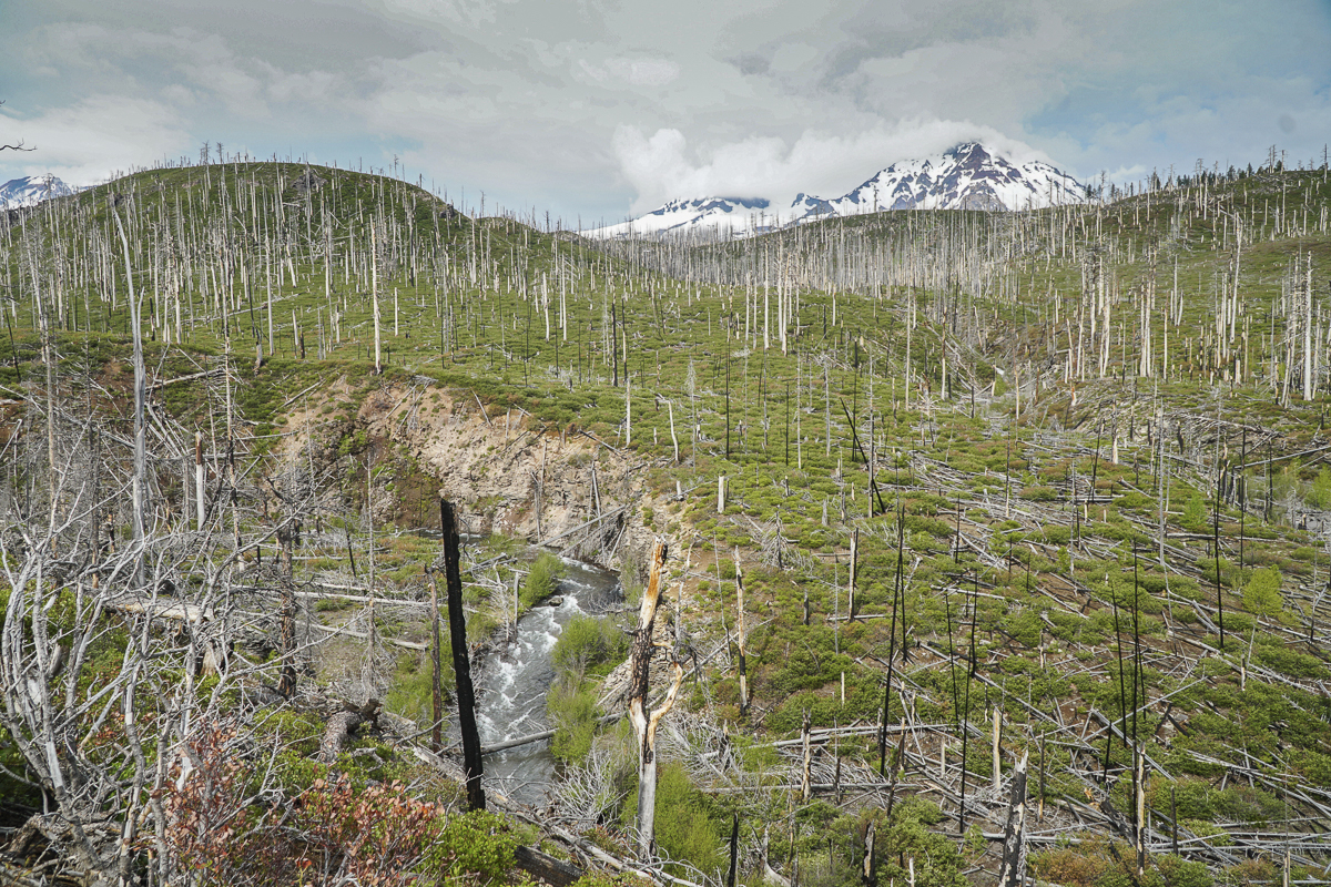
We have hiked Paulina Peak a number of times over several years, but haven't had the opportunity to do so this year until last Saturday, June 10, 2023. After a long winter with a lot of snowfall later in the season, access to higher elevations has been limited. However, the road to Paulina Peak provided us who hiked or mountain biked a chance to climb to almost 8000 feet and experience the beautiful views available from the top.
The road to Paulina Peak climbs 1600 feet over 3.75 miles, slightly longer than the trail, but easier to travel on, especially with snow on the trail and no motorized vehicles allowed to drive the road yet. While people were entering Newberry Volcanic National Monument and driving to Paulina and Eastlake, we saw no other hikers on the road to the Peak while we were there. Rather, only one mountain biker passed us during our hike and we chatted for a bit at the viewpoint at the top before he headed down. All in all, it was a wonderful day for a great hike in Central Oregon.
 |
 |
6
Tumalo Mountain Hike June 2023
Tumalo Mountain Trail Covered With Snow
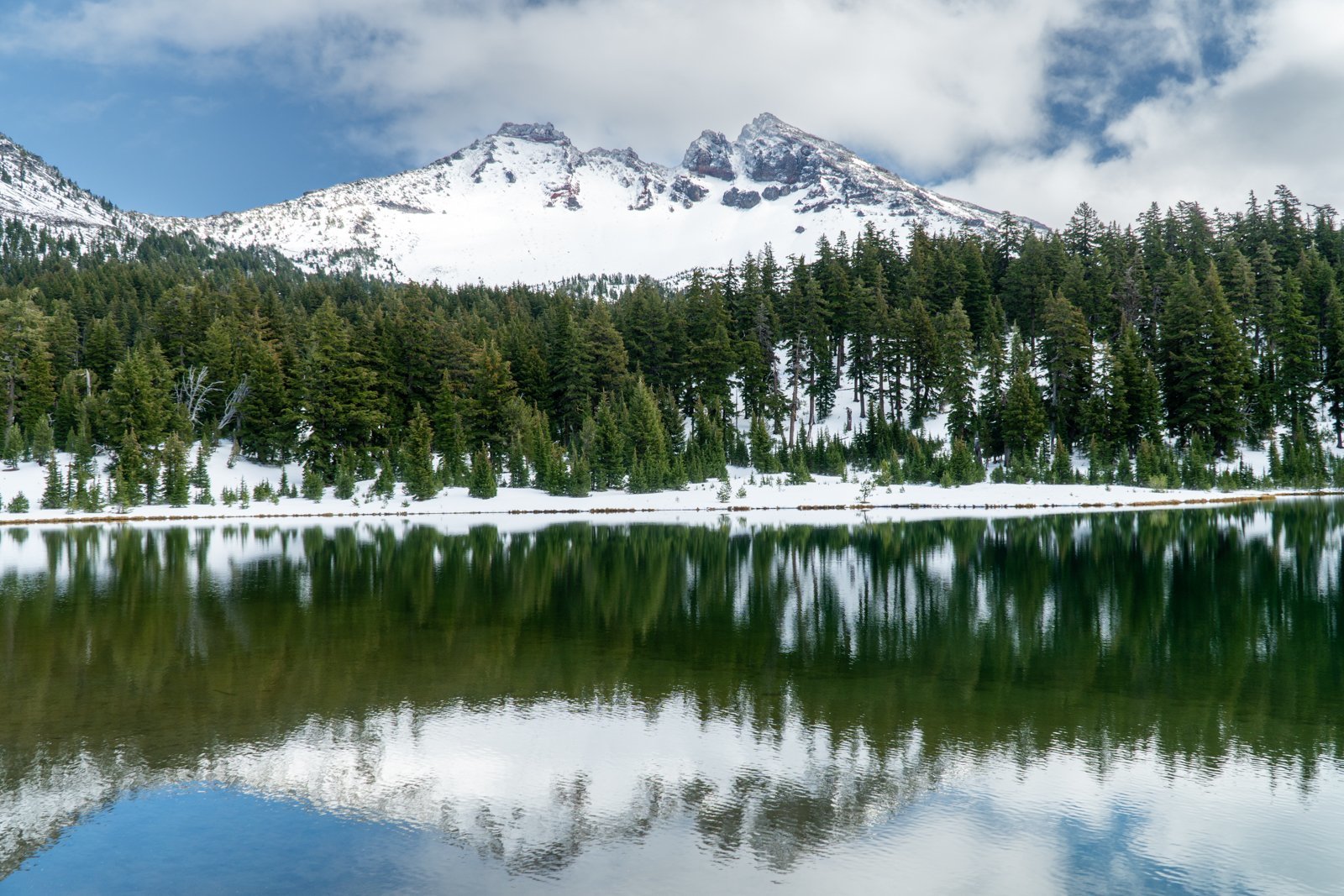
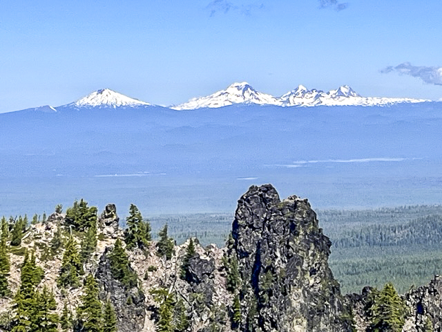
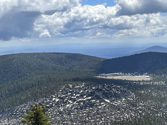
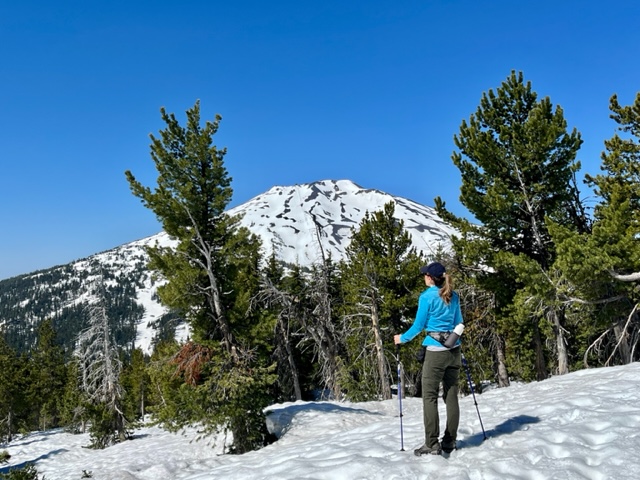
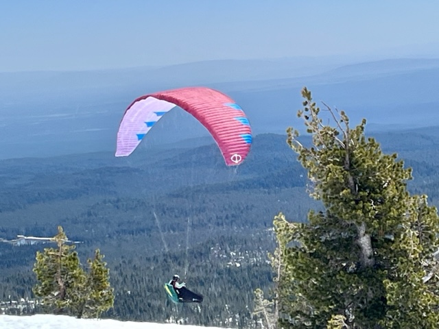
We typically hike Tumalo Mountain once a year - usually late spring/early summer once the snow melts. However, we have been anxious to get back into the Cascades after a winter of hiking in the High Desert and the opportunity to tackle Tumalo Mountain arose last Saturday. Tumalo Mountain, just north east of Mt. Bachelor, has a height of 7,779 feet. The hike up to its peak climbs over 1400 feet in two miles and is considered difficult due to its steepness. However, we have never attempted this hike with snow on the ground and found the trail challenging. The snow drifts were from 3 to 6 feet, although the snow was compacted and we managed with a GPS to somewhat follow the trail to the summit using trekking poles and micro spikes. Once reaching the summit, the views towards Mt Bachelor and towards the Three Sisters and Broken Top were outstanding. After enjoying the views and a quick lunch, the return trip had additional challenges as the snow softened with the warm weather. All in all, we saw only one other hiking couple and a pair of paragliders jumping from the peak on our return. It will be awhile before the snow fully melts in the Cascades after the winter storms. But in the meantime, we will take advantage of any hike we can access as soon as it becomes passible.
 |
 |
 |
 |
29
Upper Chush Falls is Such a Surprise
Chush Falls is Snow Free and Ready for Hikers
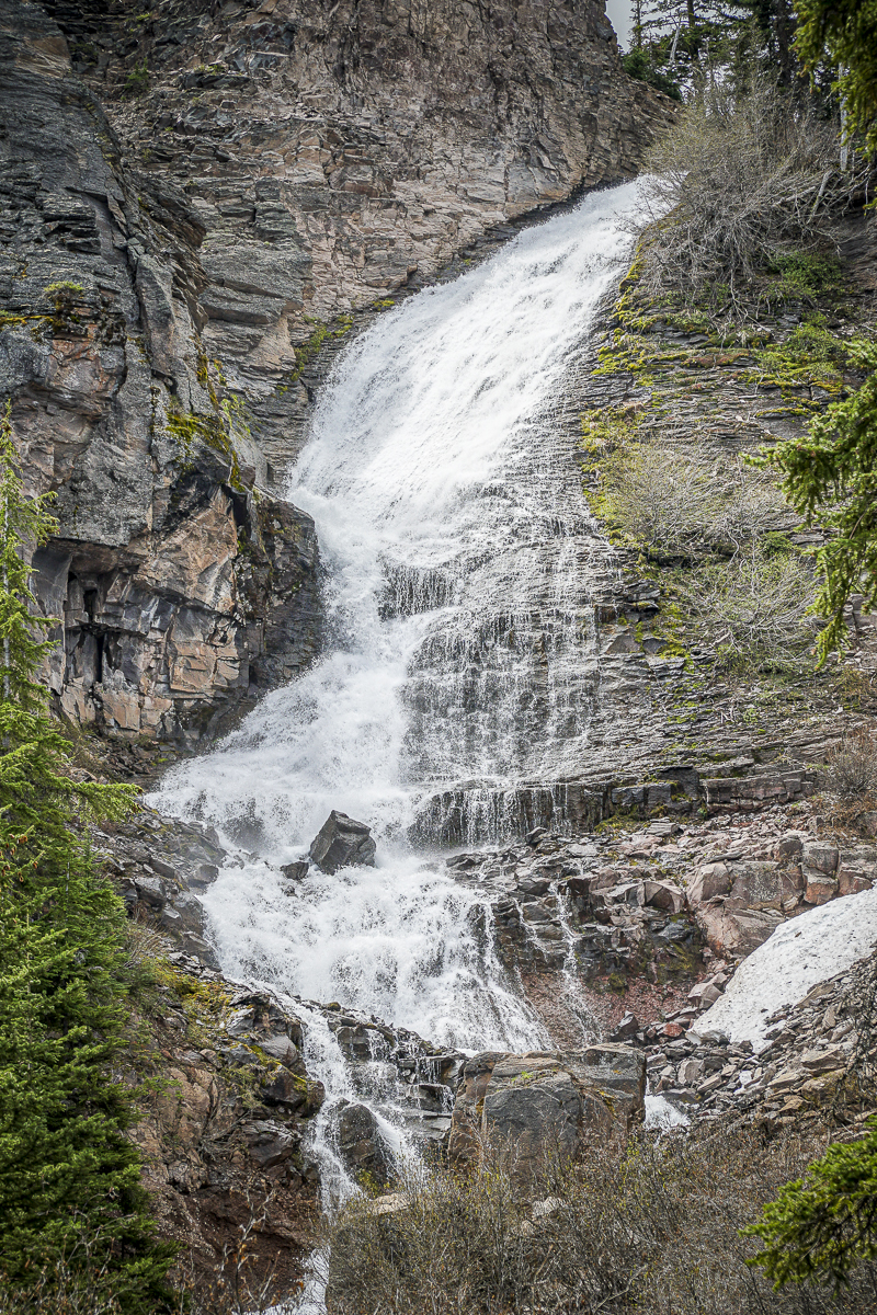
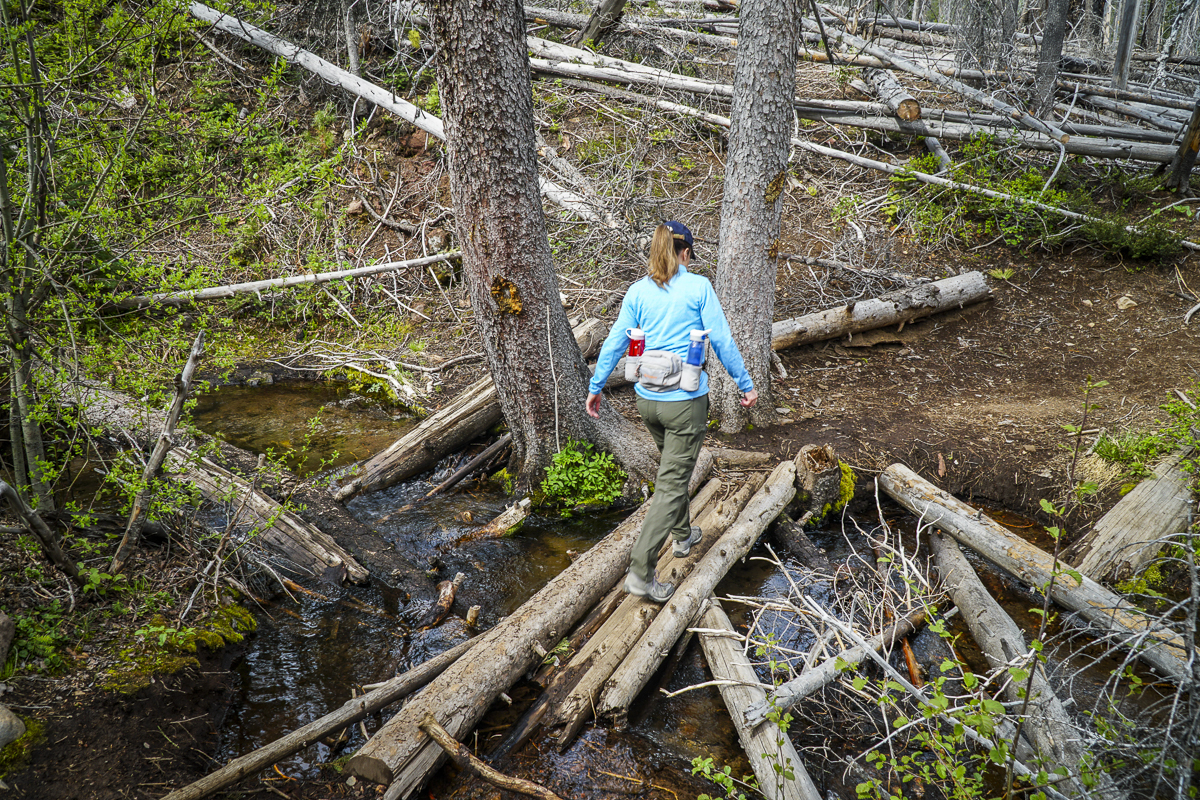
We have hiked Chush Falls several times, usually during the fall or winter with snow and ice. However, this Memorial Day weekend we elected to take the hike in the Three Sisters National Wilderness snow free. Unlike earlier hikes, many of the recently downed trees from the 2017 Milli Fire had been cut which enabled us to more easily hike the first two miles. However, the last quarter to half mile to the viewpoint had yet to receive this attention and scrambling over and under downed trees can always create challenges. The viewpoint overlooking Chush Falls is fairly obstructed by trees, so we typically take the very steep path down to the base of the falls, a path which should only be taken by people who are fit enough to make it both down and up. We had never seen the 60 foot Chush Falls as full as it was with the snow runoff from our wet winter really impacting the rivers and streams. Unlike winter time, if we got close to the falls, we would have been quite wet so we stayed a bit back and enjoyed the view from a distance.
 After clambering back up to the viewpoint, we decided to extend the hike to Upper Chush Falls, having never gone past Lower Chush Falls during our previous winter hikes. No attempt had been made to clear any downed trees, so hiking with GPS was very helpful since we often had to leave the path to maneuver around large fallen trees. It wasn't far past Lower Chush Falls that we reached the first lovely waterfall, the Cascades. Located on Whychus Creek just above the confluence with Park Creek, the Cascades is viewable just from the trail, without an easy way to get closer. Continuing past the Cascades, within a half mile we were surprised to see the spectacular, 200 foot Upper Chush Falls. For those of us familiar with Central Oregon waterfalls, Bend's popular Tumalo Falls is 97 feet. We didn't expect to see such a beautiful, towering waterfall. Following a social trail, we attempted to find a great viewpoint, but ended up on a steep ledge which felt a bit perilous, so we backtracked down to the base of the falls, getting as close as the vegetation would allow. All in all, we were very happy with our decision to hike the extra distance to experience all 3 waterfalls. Per GPS, we traveled a total of 6.25 miles with 950 feet of elevation gain (more than most trails note due to our steep side trips).
 |
 |
2
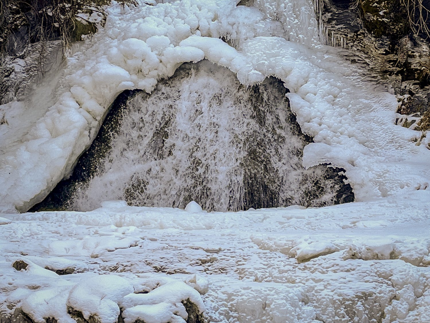
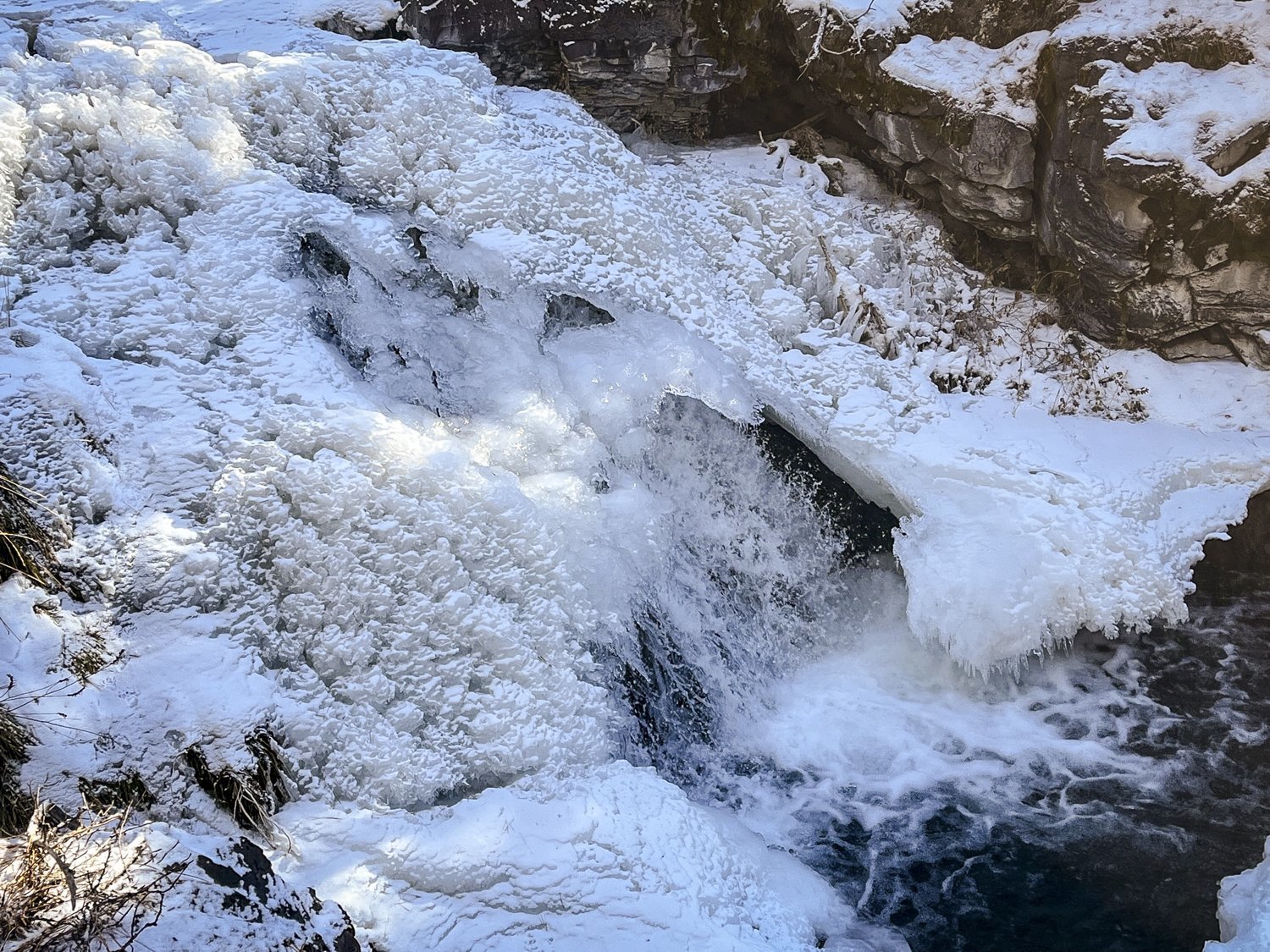
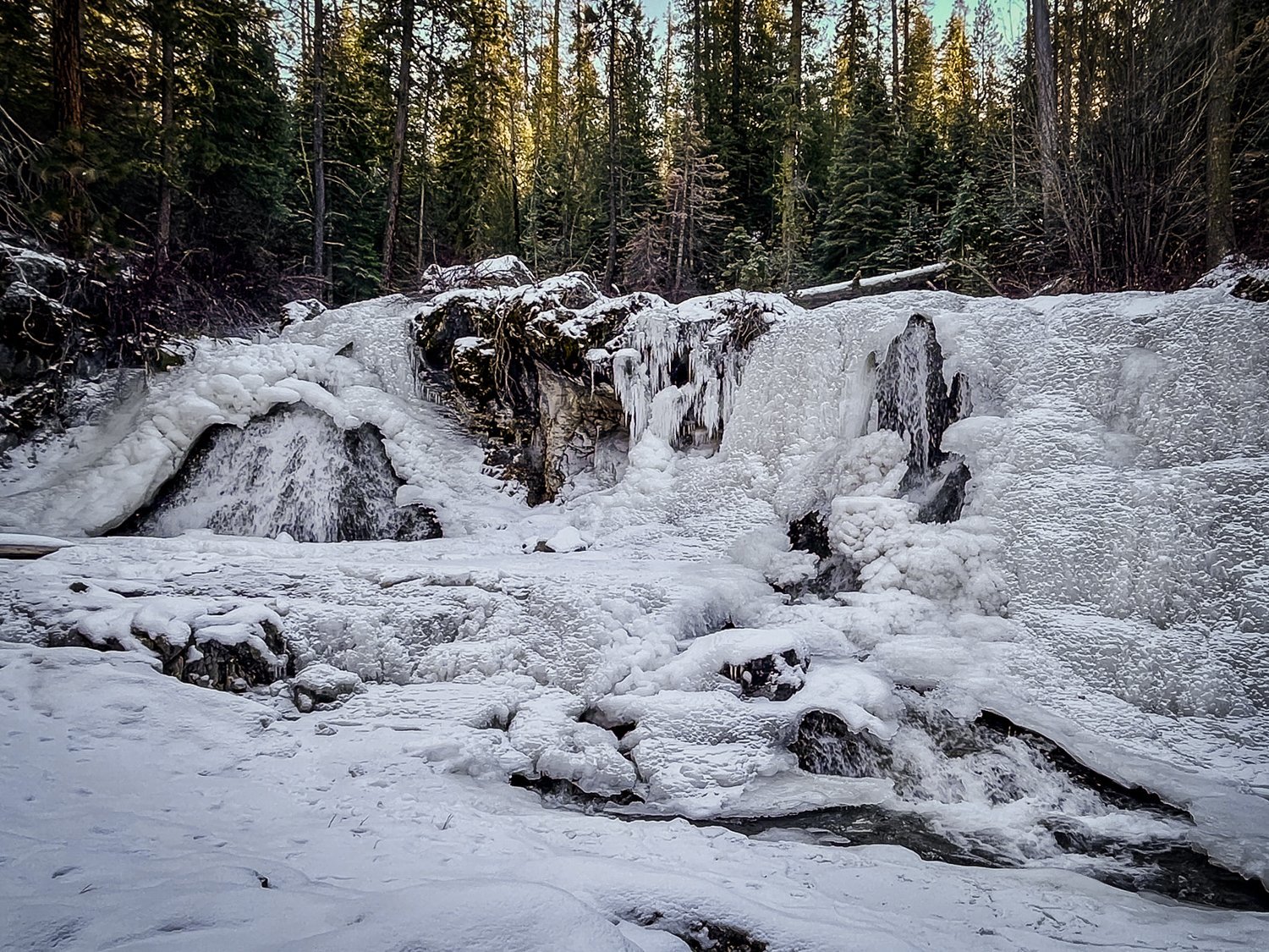
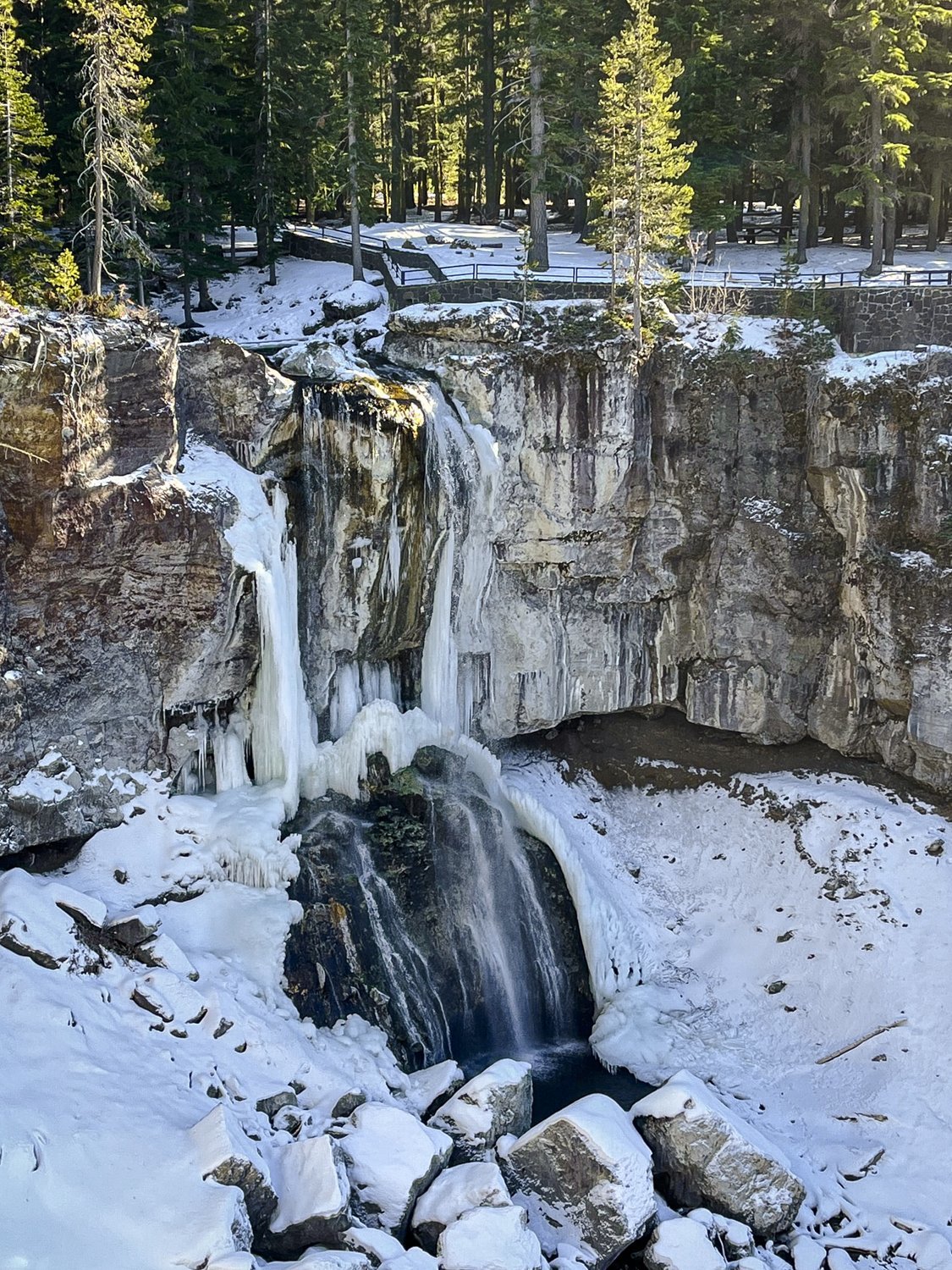
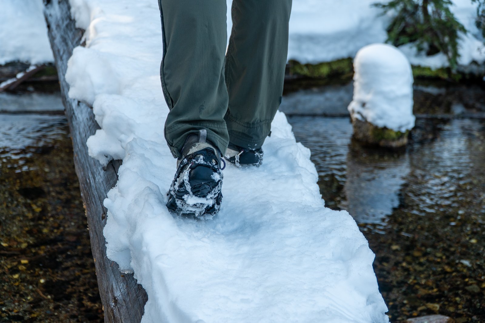
Chasing Frozen Waterfalls in Central Oregon
Paulina Creek in Late Fall Worth Seeing
We have hiked the Peter Skene Ogden trail many times, but we never tire of doing this when the weather turns cold. Paulina Creek freezes and the multiple waterfalls along the trail turn into beautiful works of art with ice sculpted into interesting shapes. The sounds of the running water are also muffled when the ice gets deeper and the quiet and isolation of the hike will amaze. On November 26, 2022 we hiked Peter Skene Ogden trail from McKay Crossing campground up Paulina Creek planning on going as far as the early snow permitted. We we pleased to find we could trek the entire way to Paulina Falls using our micro spikes as the trail was icy; the deepest snow was roughly a foot in a shadowed gully roughly 2/3 of the way to Paulina Falls. During the hike we enjoyed total privacy with no other hikers seen the entire day. But the views of the partly frozen waterfalls were lovely and the 13 miles in and out were well worth the experience. We highly recommend this hike in the winter, but be prepared for deep snow as the season progresses.
 |
 |
 |
 |
4
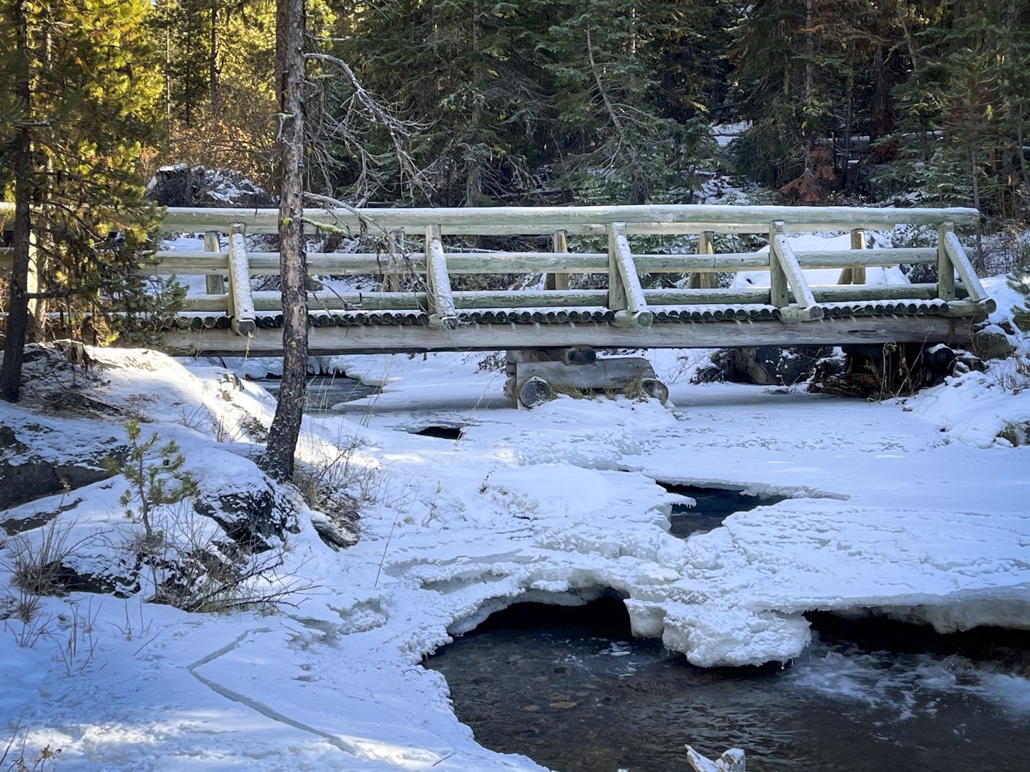
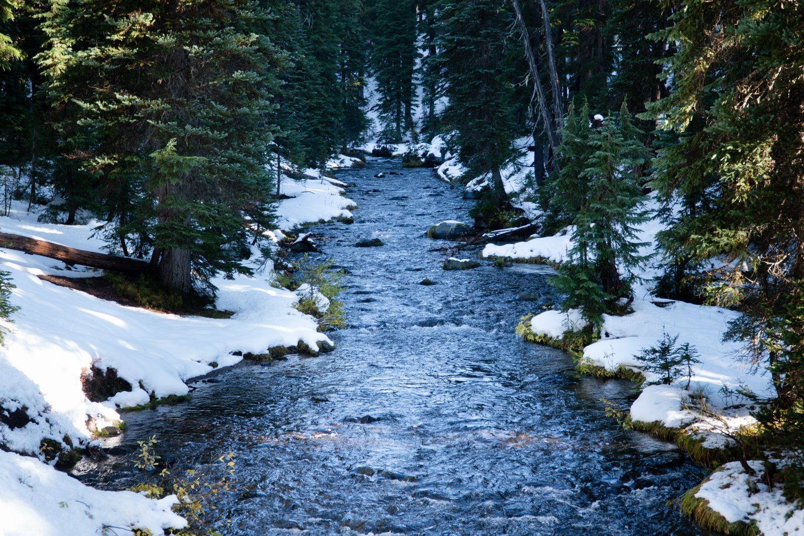
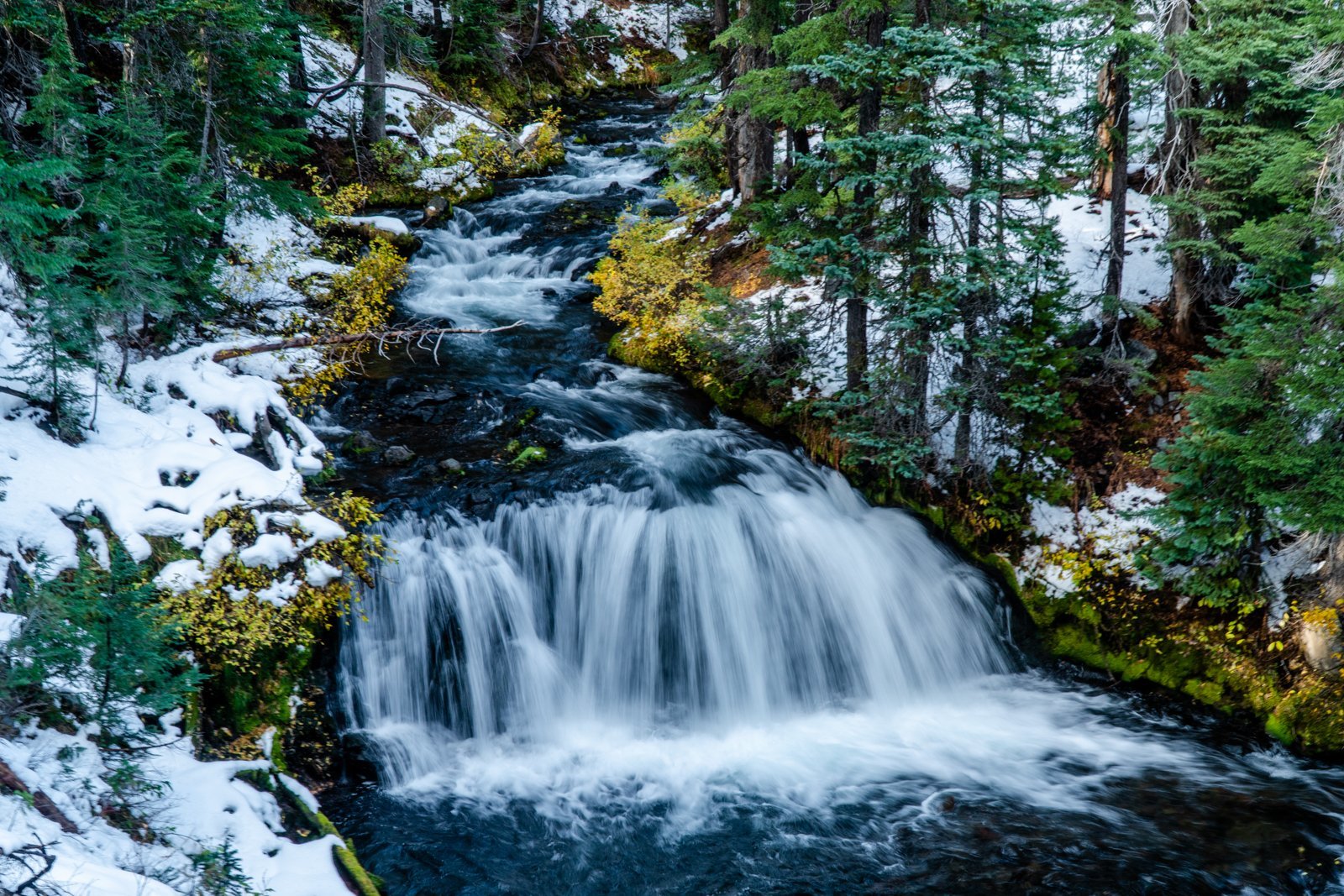
Green Lakes in the Fall, 2022
Green Lakes is One of Central Oregon's Most Beautiful Hiking Destinations
We have hiked to Green Lakes many times over the years, with each visit unique and special. However, the hike we experienced 10-29-22 has to have been among the very best, something we would call magical. The first snow of the season had fallen earlier in the week, but the day was brilliant with clean, clear air (all summer forest fires finally out due to the snow). The trail was a bit icy, but with microspikes, the packed snow was easy to manage.
 |
 |
The early snow covered a lot of the fall foliage, but Fall Creek with its numerous waterfalls was full and beautiful. And every now and then some lovely fall color could be seen.
 |
 |
When we reached Green Lakes, the handful of people we saw during the hike all traveled to the peninsula on the main, largest lake. However, we hiked to the first, smaller lake, post-holing through one foot of snow to the far side of the lake which provided us with stunning views of South Sister mirrored in the lake water. We sat on a fallen tree trunk and watched the lake and mountain for 45 minutes, seeing the clouds near South Sister's summit eventually blow away. During this time, we didn't see another person. On our return to the main trail, the views of Broken Top were the best we had ever seen from Green Lakes. It was truly a magical day.