Posts with tag 'Places to See in Central Oregon'
Subscribe and receive email notifications of new blog posts.
 RSS Feed
- 2026 | 65 Posts
- 2025 | 103 Posts
- 2024 | 110 Posts
- 2023 | 72 Posts
- 2022 | 52 Posts
- 2021 | 70 Posts
- 2020 | 84 Posts
- 2019 | 38 Posts
- 2018 | 48 Posts
- 2017 | 39 Posts
- 2016 | 31 Posts
- 2015 | 10 Posts
19
Steins Pillar Hike Still a Great Central Oregon Option Early Spring
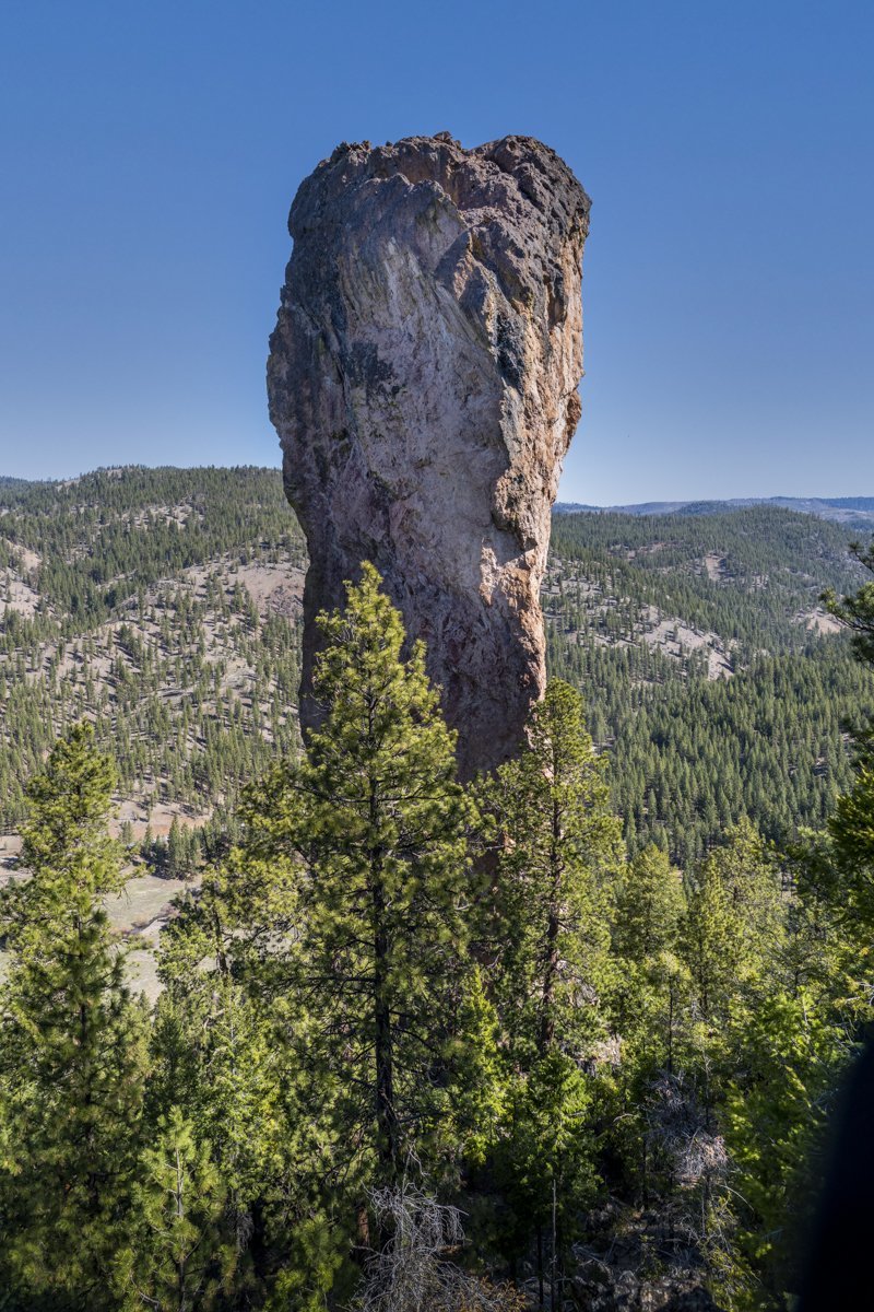
It seems that a year into the Covid-19 pandemic, we are finding ourselves repeating the hikes we took a year ago. Steins Pillar in the Ochocos is a fairly short, fairly easy hike with an impressive end at the 350 foot pillar, a volcanic remnant over 38 million years old. Probably the most concerting issue getting to the trail head is the two mile mostly single lane dirt road (within potholes) which can be somewhat sketchy going around corners, hoping no one else is coming the other way. But if you make it to the actual trail head without incident, the four-mile in and out moderate hike to the pillar has an easy to follow trail with several view points along the way. On our hike, April 17, 2021, there were just a couple of icy patches on the trail in sheltered, northern facing sl...
11
Ready for a Great Spring Hike?
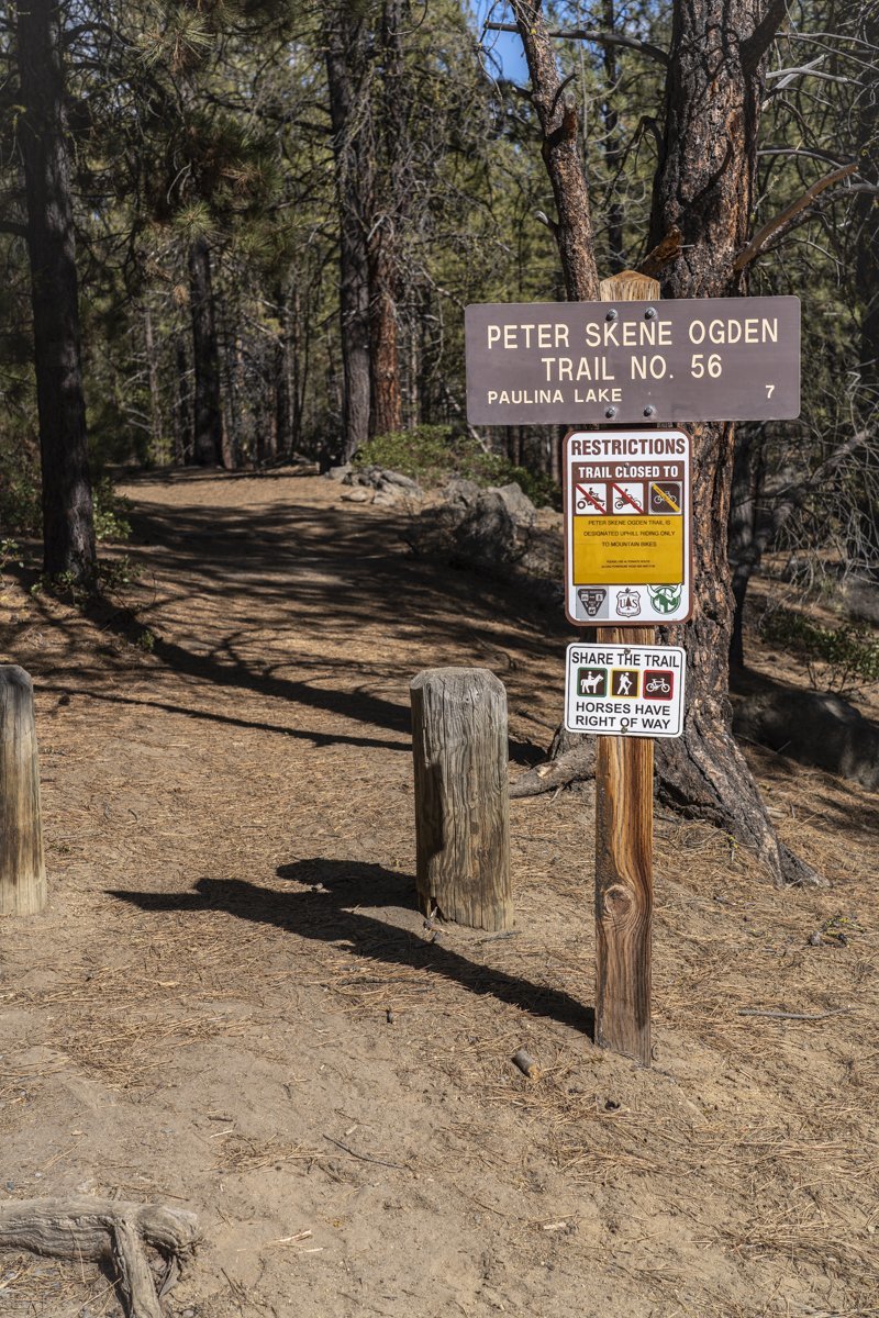
Peter Skene Ogden Trail is Ready Now!
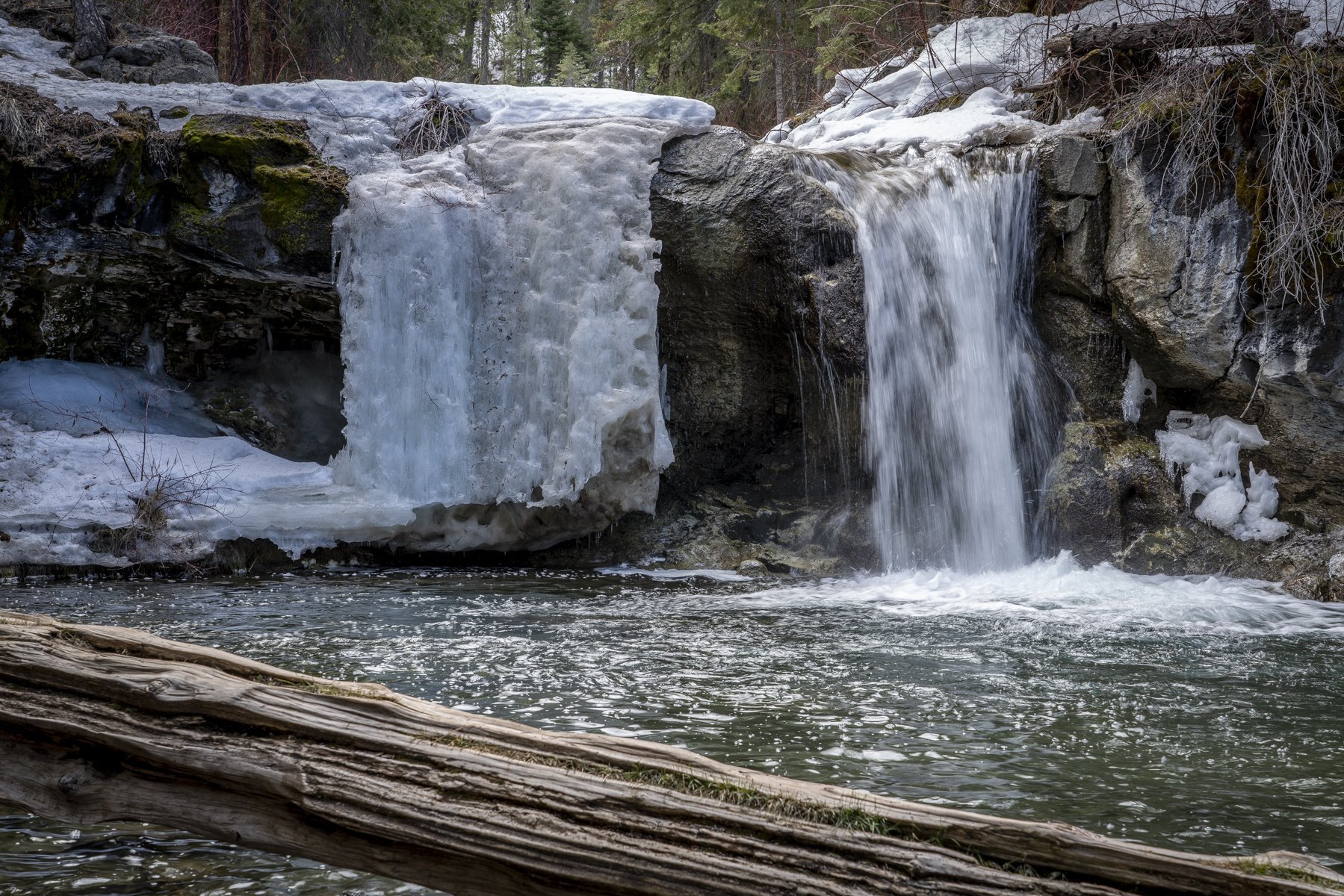
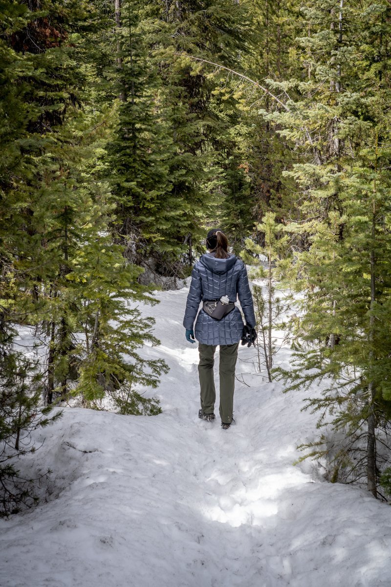
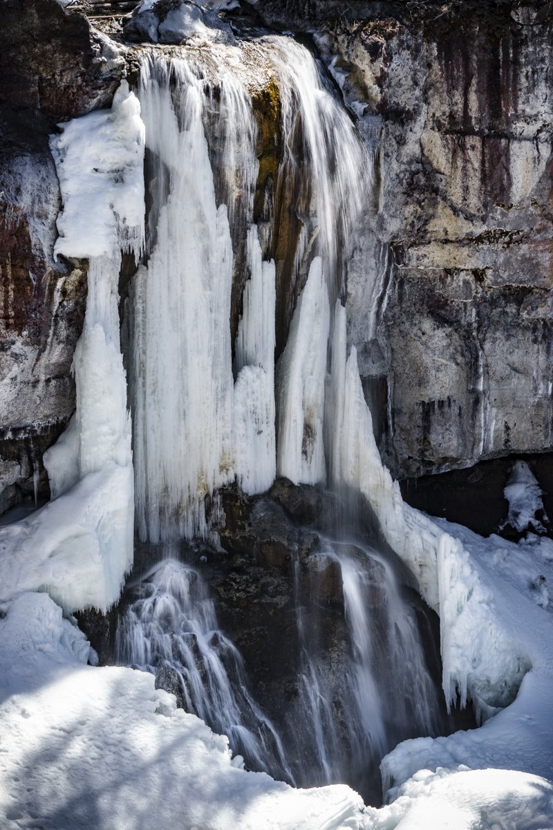
It has been just over a year since we last hiked Peter Skene Ogden Trail, located just outside Newberry National Volcanic Monument off the road to the park entrance. Last Saturday, April 10th 2021, the weather was predicted to be cool and windy and this hike, mostly sheltered from the wind in the canyon where Paulina Creek flows, seemed a good choice. When we parked our car by the trailhead at the closed McKay Crossing Campground, there was only one other car and the temperature was under 40 degrees. We thought we would hike the 3.5 miles to our favorite waterfalls along the hike - the place we call "Twin Falls." We dressed warm and quickly covered the distance to the falls. After a short stop with photos of the falls, we decided to see how much further we could make it on the hike, knowing the trail ends at Paulina Lake. We were surprised to see the trail was relatively snow free until past 4.5 miles, and then very passable with microspikes on our shoes. We made it all 7 miles to Paulina Falls where we enjoyed a quick lunch prior to starting back. Although trekking through the snow was much slower than on the bare ground, the experience was very enjoyable and yes, pretty sheltered from the wind. All in all, we saw only 6 other people and 2 dogs the entire day.
 |
 |
 |
16
Ray Benson Sno Park Provides Access to Miles of Recreational Opportunities
.jpg)
Winter hiking in snow has been a challenge for us this year since by the time we realized we needed snowshoes, they were sold out locally. Our winter hikes have involved more high desert locations with trips to Fort Rock, Whychus Canyon Preserve, Bessie Butte, Lake Billy Chinook, Blue Basin, and repeated visits to Smith Rock among our favorites. However, last Saturday we decided to visit Santiam Pass and hike the road to Big Lake.
We arrived at the Ray Benson Sno Park around 8:40 am and found many people there either camping in their RVs or setting up their snow mobiles. We slipped on ice cleats and were determined to walk the couple miles to the far west side of Big Lake where we were told the views of Mt. Washington were the best. It was a beautiful sunny day and the weather warmed as the day wore on. The views of Mt. Washington from Big Lake were stunning and we were surprised to see that the lake was still frozen to the extent that snow mobiles were driven across the ice.
After leaving the lake, we decided to take the Ray Benson Sno Loop and visit the Brandenburg Shelter. The trails were fine traveling with our snow cleats and we saw several people cross country skiing as well as snow shoeing and hiking like us. The shelter provided us with both Mt. Washington and Three Fingered Jack views and an opportunity to talk with other people enjoying the day.
All in all, we traveled roughly 10 miles and really had fun being outside in the Mt. Washington Wilderness on a late winter day.
.jpg) |
.jpg) |
9
For an Easy Hike in the High Desert, Try Fort Rock Loop
Just an Hour's Drive SE of Bend is Fort Rock State Park
.JPG)
It has been several years since we last visited the Fort Rock area located 67.7 miles SE of Bend in Lake County. Fort Rock itself is a volcanic tuff ring located on an ice age lake bed. The ring is about 4,460 feet in diameter and stands about 200 feet high above the surrounding area. Its name is obvious from its resemblance to the tall, straight walls of a fort.
When we arrived at the state park February 6th, we saw just a handful of people using the facility. We hiked the 1.1 miles around the interior of the crater, but then scrambled up the far side to the rim which provided for nice views of the mountains to the west. The hike itself was easy and would be very warm in the summer. We had hoped to combine this trip with another hike in the general area - Hole in the Ground - but the forest service road to this location was closed for the winter.
If you do go to Fort Rock, a stop at the Fort Rock Homestead Museum is very worthwhile for those who enjoy seeing how early settlers to this part of Oregon lived. When we were there February 6th, the museum was closed; not sure if this was due to Covid restrictions or if it was just a seasonal shut down.
.JPG) |
.JPG) |
6
Whychus Canyon Preserve Offers Three Varied Hikes

Our first hike of 2021 was at the Whychus Canyon Preserve, a place we had never been before. Located at the end of Goodrich Road off Cloverdale Road outside of Sisters, the preserve provides for 3 different hikes of varying difficulty and view. We took the Long Canyon Route which follows the canyon rim before dropping 300 feet in elevation into the canyon and follows the creek for 2.3 miles before climbing back to the rim. The walk on the rim travels through meadows and has a North Sister view overlook before heading back to the trailhead. All in all, the loop is roughly 5 miles and depending on the time of year, can offer wildflowers and mountain views. The other hikes in the Whychus Canyon Preserve include the Mid Canyon Route, shorter with only 3 miles, and the Wagon Road and Meadow Loop (2.5 miles). The Wagon Road follows a portion of the historic Santiam Wagon Road and includes interpretive signs which discuss the Santiam toll road which was the way early settlers in Oregon traveled back and forth from the Willamette Valley to Central Oregon in the 1860s.
If you plan on hiking in the Whychus Canyon Preserve, come early as there is limited parking; off road parking is not permitted and dogs must be kept on leash.
 |
 |
