Posts with tag 'Central Oregon Hikes'
Subscribe and receive email notifications of new blog posts.
 RSS Feed
- 2026 | 65 Posts
- 2025 | 103 Posts
- 2024 | 110 Posts
- 2023 | 72 Posts
- 2022 | 52 Posts
- 2021 | 70 Posts
- 2020 | 84 Posts
- 2019 | 38 Posts
- 2018 | 48 Posts
- 2017 | 39 Posts
- 2016 | 31 Posts
- 2015 | 10 Posts
17
Bend Premier Real Estate | June 2022 Newsletter
What's in the June, 2022 Newsletter?
- Bend Oregon Real Estate - May 2022 Trends
- A Quick Lunch Bite in Downtown Bend
- A Checklist for Selling Your House
- Safety Tips for Doggy Doors
- Move Up This Summer
20
Bend Premier Real Estate | May 2022 Newsletter
What's in the May 2022 Newsletter?
- Bend Oregon Real Estate - April 2022 Sales
- Belknap Crater - a Unique Hiking Experience in the Mt. Washington Wilderness
- Myths About Today's Housing Market
- A Tantalizing Wine Experience in Bend
- Give Your Curb Appeal a Boost Before You Sell
12
Bend Premier Real Estate | January 2022 Newsletter
What's in the January 2022 Newsletter?
- Bend Real Estate Sales - 2021 Trends & 2022 Predictions
- Covid Cases Spiking in Deschutes County
- 2022 Paint Colors of the Year
- Top Hikes of 2021
- 2022 Housing Market Forecast
14
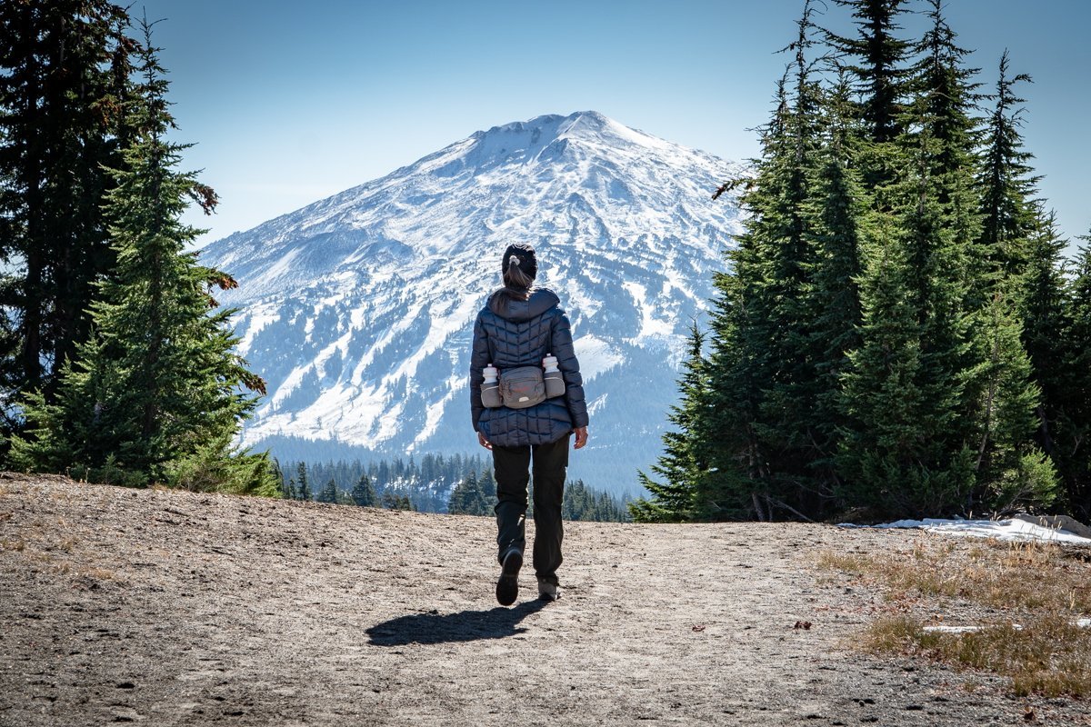
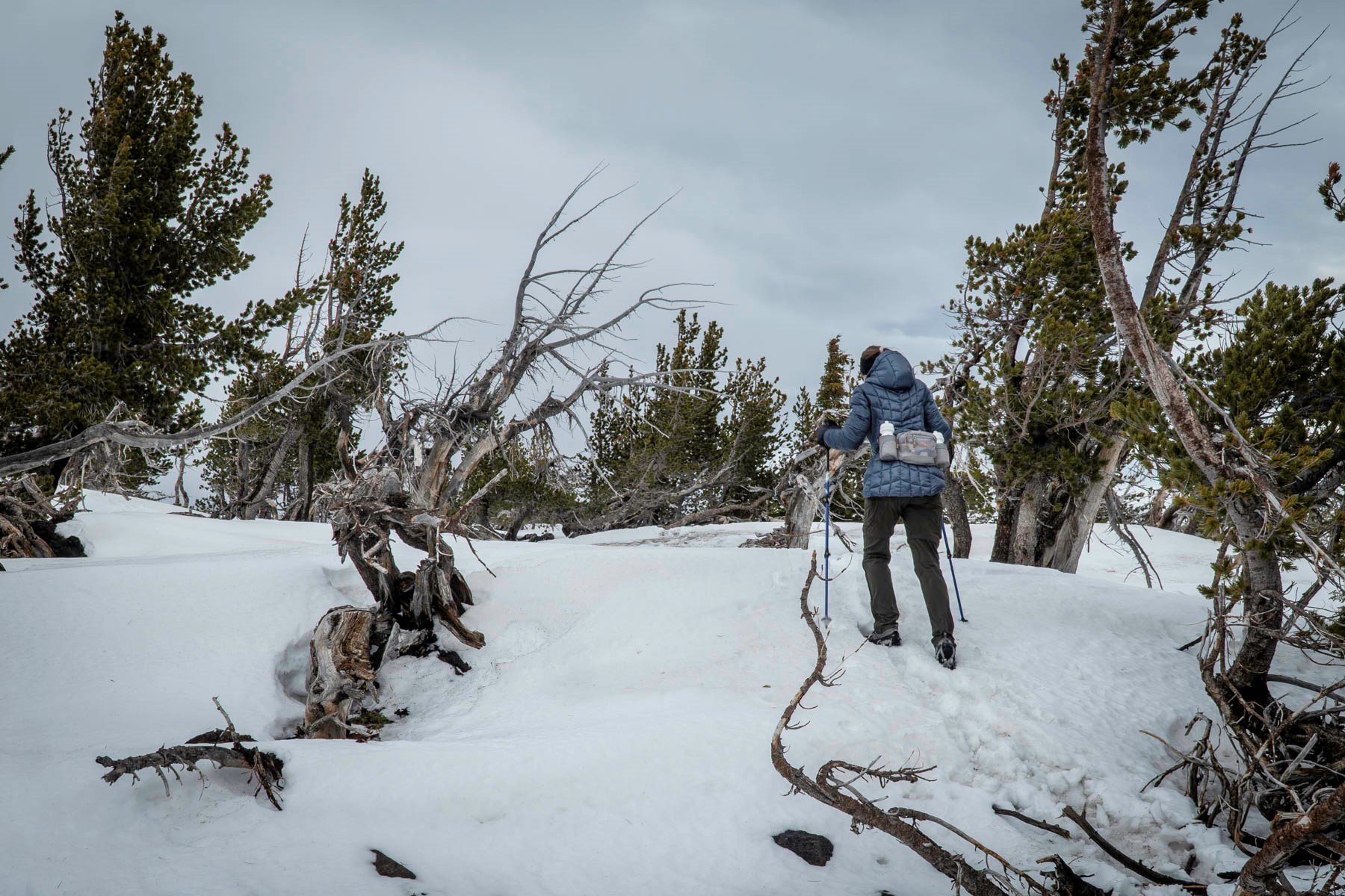
Tam McArthur Rim Trail in Snow Late Fall
One of Central Oregon's more popular summer hikes in the Three Sisters Wilderness, we decided to hike Tam McArthur Rim 11-27-21 a few days after the first snow of autumn had fallen. Three Creeks Lake had icy sections and only one other couple started the hike just a few minutes before us.
We began our hike utilizing microspikes as the trail was icy and the added gripping security microspikes offer enabled us to quickly climb the initial miles of the hike. The snow deepened as we climbed and the trail became less obvious. However, we were able to follow the tracks of the couple who started the hike just before us, trusting that they knew where they were going.
The hike to Tam McArthur Rim levels out near the summit into an open meadow. On this hike the end of November, we found the wind really picked up here. The final push to the summit was through shin deep snow and while accomplishing the destination of the hike, the cloud cover dropped and our views of the Three Sisters and Broken Top were obscured. We had hoped to take the "unofficial" trail from the Rim to Broken Hand to add additional distance and views to our hike, but with the cloud cover so low and fearful that it would start snowing again, and with no tracks to follow, we returned the way we came. On the way down we passed a few hiking parties coming up.
All in all, it was a fairly quick hike with a total of 5.3 miles in and back and 1246 feet of elevation gain. We hope to take more of these types of hikes, weather permitting, as we enter winter.
 |
 |
20
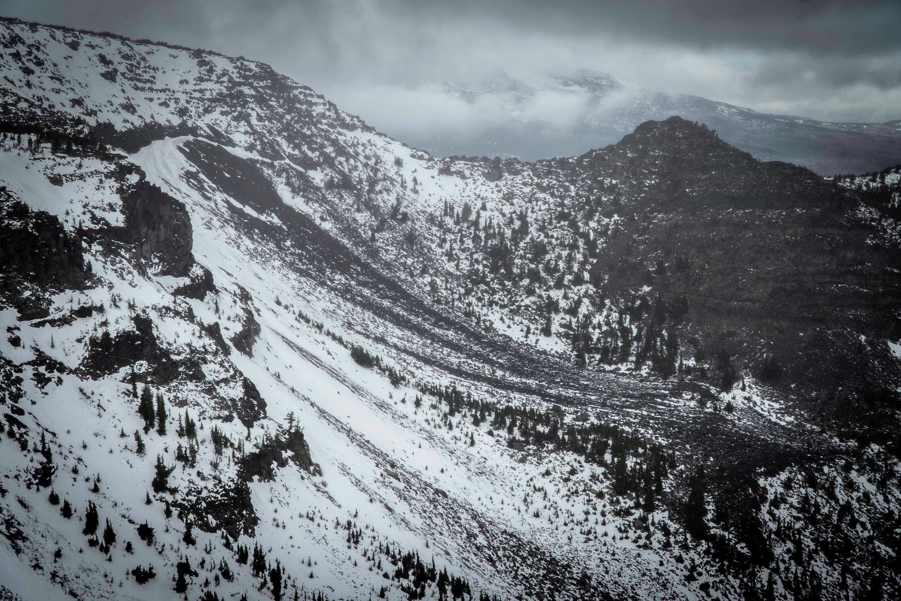
Soda Creek to No Name Lake at Broken Top a Challenging But Wonderful Central Oregon Hike
October 16, 2021 was probably one of the most beautiful fall days in Central Oregon that we have seen for many years. The cool weather in the morning warmed during the day and the sky was a perfect blue with a few high clouds. The snow that fell on the mountains earlier in the week had melted some and it was a great day to take a long hike in the Cascades. We started off the day deciding to hike the Three Sisters Wilderness loop from Soda Creek around Broken Top to Green Lakes and back via Fall Creek to the trailhead. 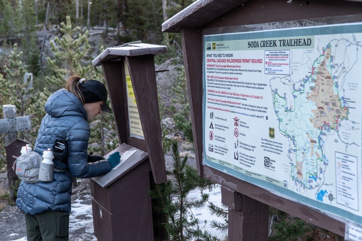 We had taken this hike last year in late October and thought it would be good to do again. However, 4.5 miles into the hike the trail branches northeast to Broken Top and ultimately No Name Lake. This time we elected to take the longer hike to Broken Top.
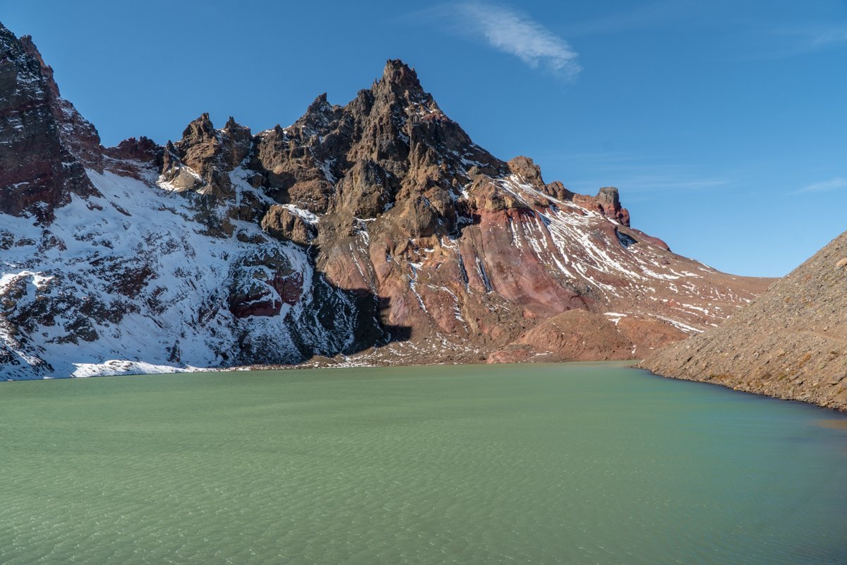
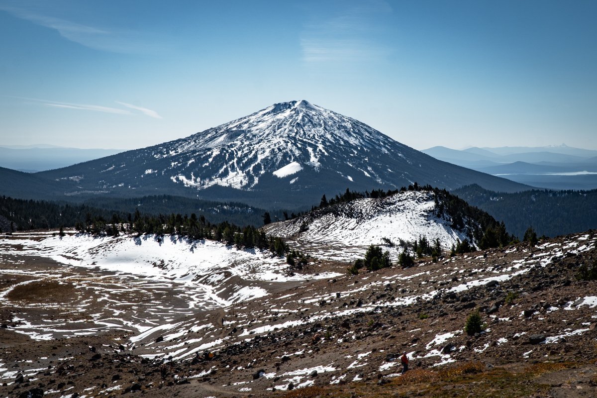
Starting the hike around 8:30 am, we saw just a couple of people on the path from the Soda Creek trailhead (shares the same parking lot as Green Lakes) to the junction with the Broken Top trail. As the path climbed, we entered a meadow from which a number of springs flowed and the beautiful colors of Broken Top became more evident. Crossing the Crater Ditch trail, we saw a social trail that climbed steeply to an overlook which provided amazing views of Broken Top's south slope and with a 180 degree turn south, provided some spectacular views of Mt. Bachelor. We decided to travel cross country up a draw to join with the main Broken Top trail and continue on to No Name Lake. The main trail had more people on it, enjoying the beautiful day as we were. Arriving at No Name Lake, the wind picked up, especially at the outlet to the lake where the surrounding moraines channeled the air. It was nice to see the beautiful aqua blue color of the lake returning several years after the avalanche which killed 19 elk in 2017 and deposited a lot of dirt in the water.
After a short stay for lunch at No Name Lake, we returned via the main trail to our cut off through the meadow and back to the Soda Creek trail. We arrived at our car around 4:30. All in all, the hike was roughly 16 miles with 3100 feet of elevation gain. It was a full day with wonderful views and a great experience.
 |
 |